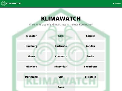
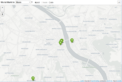
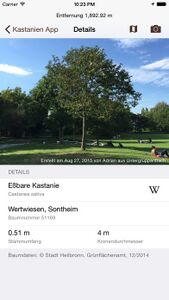
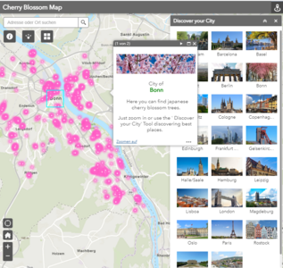
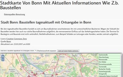
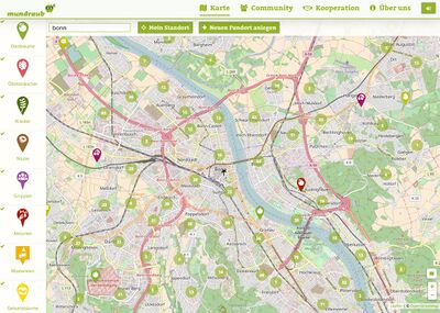
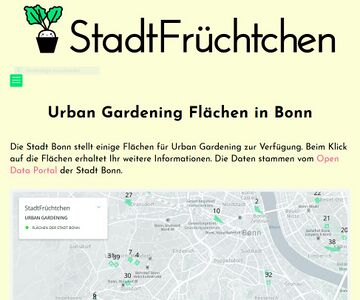
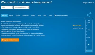
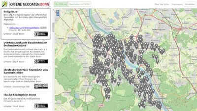
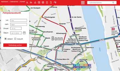
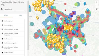
Best Practices - Diese Anwendungen wurden bereits auf Basis offener Datenbestände für das Bonner Stadtgebiet entwickelt:
Galerie
Lade …
An diesen Orten sind Anwendungen auf Basis offener Daten für Bonn entstanden
Die Karte wird geladen …
{"format":"leaflet","minzoom":false,"maxzoom":false,"limit":1000,"offset":0,"link":"all","sort":[""],"order":[],"headers":"show","mainlabel":"","intro":"","outro":"","searchlabel":"","default":"","import-annotation":false,"width":"auto","height":"400px","centre":false,"title":"","label":"","icon":"","lines":[],"polygons":[],"circles":[],"rectangles":[],"copycoords":false,"static":false,"zoom":false,"defzoom":14,"layers":["OpenStreetMap"],"image layers":[],"overlays":[],"resizable":false,"fullscreen":false,"scrollwheelzoom":true,"cluster":false,"clustermaxzoom":20,"clusterzoomonclick":true,"clustermaxradius":80,"clusterspiderfy":true,"geojson":"","clicktarget":"","showtitle":true,"hidenamespace":true,"template":"","userparam":"","activeicon":"","pagelabel":false,"ajaxcoordproperty":"","ajaxquery":"","locations":[{"text":"\u003Cb\u003E\u003Ca href=\"/Bus_und_Bahn_Liniennetzplan\" title=\"Bus und Bahn Liniennetzplan\"\u003EBus und Bahn Liniennetzplan\u003C/a\u003E\u003C/b\u003E\u003Chr /\u003E\u003Ca href=\"/Attribut:Ersteller\" title=\"Attribut:Ersteller\"\u003EErsteller\u003C/a\u003E: Stadtwerke Bonn\u003Cbr /\u003E\u003Ca href=\"/Attribut:Devices\" title=\"Attribut:Devices\"\u003EDevices\u003C/a\u003E: Browser\u003Cbr /\u003E\u003Cspan class=\"smw-highlighter\" data-type=\"1\" data-state=\"inline\" data-title=\"Attribut\" title=\"Kategorienzuordnung entsprechen des Govdata-Schemas.\"\u003E\u003Cspan class=\"smwtext\"\u003E\u003Ca href=\"/Attribut:Kategorie_meta\" title=\"Attribut:Kategorie meta\"\u003EKategorie\u003C/a\u003E\u003C/span\u003E\u003Cspan class=\"smwttcontent\"\u003EKategorienzuordnung entsprechen des Govdata-Schemas.\u003C/span\u003E\u003C/span\u003E\u0026nbsp;\u003Cspan title=\"Kategorie meta\"\u003E\u003Csup\u003E\u1d56\u003C/sup\u003E\u003C/span\u003E: \u003Ca href=\"/Transport_und_Verkehr\" title=\"Transport und Verkehr\"\u003ETransport und Verkehr\u003C/a\u003E","title":"Bus und Bahn Liniennetzplan","link":"","lat":50.739877,"lon":7.1022898,"icon":""},{"text":"\u003Cb\u003E\u003Ca href=\"/CityKey_App\" title=\"CityKey App\"\u003ECityKey App\u003C/a\u003E\u003C/b\u003E\u003Chr /\u003E\u003Ca href=\"/Attribut:Ersteller\" title=\"Attribut:Ersteller\"\u003EErsteller\u003C/a\u003E: Deutsche Telekom\u003Cbr /\u003E\u003Ca href=\"/Attribut:Devices\" title=\"Attribut:Devices\"\u003EDevices\u003C/a\u003E: iOS\u003Cbr /\u003E\u003Cspan class=\"smw-highlighter\" data-type=\"1\" data-state=\"inline\" data-title=\"Attribut\" title=\"Kategorienzuordnung entsprechen des Govdata-Schemas.\"\u003E\u003Cspan class=\"smwtext\"\u003E\u003Ca href=\"/Attribut:Kategorie_meta\" title=\"Attribut:Kategorie meta\"\u003EKategorie\u003C/a\u003E\u003C/span\u003E\u003Cspan class=\"smwttcontent\"\u003EKategorienzuordnung entsprechen des Govdata-Schemas.\u003C/span\u003E\u003C/span\u003E\u0026nbsp;\u003Cspan title=\"Kategorie meta\"\u003E\u003Csup\u003E\u1d56\u003C/sup\u003E\u003C/span\u003E: \u003Ca href=\"/Geographie;_Geologie_und_Geobasisdaten\" title=\"Geographie; Geologie und Geobasisdaten\"\u003EGeographie; Geologie und Geobasisdaten\u003C/a\u003E","title":"CityKey App","link":"","lat":50.717877092029,"lon":7.1435473318127,"icon":""},{"text":"\u003Cb\u003E\u003Ca href=\"/Kastanien_App\" title=\"Kastanien App\"\u003EKastanien App\u003C/a\u003E\u003C/b\u003E\u003Chr /\u003E\u003Ca href=\"/Attribut:Ersteller\" title=\"Attribut:Ersteller\"\u003EErsteller\u003C/a\u003E: GrundID GmbH\u003Cbr /\u003E\u003Ca href=\"/Attribut:Devices\" title=\"Attribut:Devices\"\u003EDevices\u003C/a\u003E: iOS\u003Cbr /\u003E\u003Cspan class=\"smw-highlighter\" data-type=\"1\" data-state=\"inline\" data-title=\"Attribut\" title=\"Kategorienzuordnung entsprechen des Govdata-Schemas.\"\u003E\u003Cspan class=\"smwtext\"\u003E\u003Ca href=\"/Attribut:Kategorie_meta\" title=\"Attribut:Kategorie meta\"\u003EKategorie\u003C/a\u003E\u003C/span\u003E\u003Cspan class=\"smwttcontent\"\u003EKategorienzuordnung entsprechen des Govdata-Schemas.\u003C/span\u003E\u003C/span\u003E\u0026nbsp;\u003Cspan title=\"Kategorie meta\"\u003E\u003Csup\u003E\u1d56\u003C/sup\u003E\u003C/span\u003E: \u003Ca href=\"/Umwelt_und_Klima\" title=\"Umwelt und Klima\"\u003EUmwelt und Klima\u003C/a\u003E","title":"Kastanien App","link":"","lat":49.0974427,"lon":9.2735201,"icon":""},{"text":"\u003Cb\u003E\u003Ca href=\"/Klimawatch\" title=\"Klimawatch\"\u003EKlimawatch\u003C/a\u003E\u003C/b\u003E\u003Chr /\u003E\u003Ca href=\"/Attribut:Ersteller\" title=\"Attribut:Ersteller\"\u003EErsteller\u003C/a\u003E: Code for M\u00fcnster\u003Cbr /\u003E\u003Ca href=\"/Attribut:Devices\" title=\"Attribut:Devices\"\u003EDevices\u003C/a\u003E: Browser\u003Cbr /\u003E\u003Cspan class=\"smw-highlighter\" data-type=\"1\" data-state=\"inline\" data-title=\"Attribut\" title=\"Kategorienzuordnung entsprechen des Govdata-Schemas.\"\u003E\u003Cspan class=\"smwtext\"\u003E\u003Ca href=\"/Attribut:Kategorie_meta\" title=\"Attribut:Kategorie meta\"\u003EKategorie\u003C/a\u003E\u003C/span\u003E\u003Cspan class=\"smwttcontent\"\u003EKategorienzuordnung entsprechen des Govdata-Schemas.\u003C/span\u003E\u003C/span\u003E\u0026nbsp;\u003Cspan title=\"Kategorie meta\"\u003E\u003Csup\u003E\u1d56\u003C/sup\u003E\u003C/span\u003E: \u003Ca href=\"/Umwelt_und_Klima\" title=\"Umwelt und Klima\"\u003EUmwelt und Klima\u003C/a\u003E","title":"Klimawatch","link":"","lat":51.956491926734,"lon":7.6355019306301,"icon":""},{"text":"\u003Cb\u003E\u003Ca href=\"/Mundraub\" title=\"Mundraub\"\u003EMundraub\u003C/a\u003E\u003C/b\u003E\u003Chr /\u003E\u003Ca href=\"/Attribut:Ersteller\" title=\"Attribut:Ersteller\"\u003EErsteller\u003C/a\u003E: Terra Concordia gUG Deutschland\u003Cbr /\u003E\u003Ca href=\"/Attribut:Devices\" title=\"Attribut:Devices\"\u003EDevices\u003C/a\u003E: Browser\u003Cbr /\u003E\u003Cspan class=\"smw-highlighter\" data-type=\"1\" data-state=\"inline\" data-title=\"Attribut\" title=\"Kategorienzuordnung entsprechen des Govdata-Schemas.\"\u003E\u003Cspan class=\"smwtext\"\u003E\u003Ca href=\"/Attribut:Kategorie_meta\" title=\"Attribut:Kategorie meta\"\u003EKategorie\u003C/a\u003E\u003C/span\u003E\u003Cspan class=\"smwttcontent\"\u003EKategorienzuordnung entsprechen des Govdata-Schemas.\u003C/span\u003E\u003C/span\u003E\u0026nbsp;\u003Cspan title=\"Kategorie meta\"\u003E\u003Csup\u003E\u1d56\u003C/sup\u003E\u003C/span\u003E: \u003Ca href=\"/Umwelt_und_Klima\" title=\"Umwelt und Klima\"\u003EUmwelt und Klima\u003C/a\u003E","title":"Mundraub","link":"","lat":52.49048,"lon":13.44924,"icon":""},{"text":"\u003Cb\u003E\u003Ca href=\"/Offene_Geodaten_Bonn\" title=\"Offene Geodaten Bonn\"\u003EOffene Geodaten Bonn\u003C/a\u003E\u003C/b\u003E\u003Chr /\u003E\u003Ca href=\"/Attribut:Ersteller\" title=\"Attribut:Ersteller\"\u003EErsteller\u003C/a\u003E: Christoph Grenz\u003Cbr /\u003E\u003Ca href=\"/Attribut:Devices\" title=\"Attribut:Devices\"\u003EDevices\u003C/a\u003E: Browser\u003Cbr /\u003E\u003Cspan class=\"smw-highlighter\" data-type=\"1\" data-state=\"inline\" data-title=\"Attribut\" title=\"Kategorienzuordnung entsprechen des Govdata-Schemas.\"\u003E\u003Cspan class=\"smwtext\"\u003E\u003Ca href=\"/Attribut:Kategorie_meta\" title=\"Attribut:Kategorie meta\"\u003EKategorie\u003C/a\u003E\u003C/span\u003E\u003Cspan class=\"smwttcontent\"\u003EKategorienzuordnung entsprechen des Govdata-Schemas.\u003C/span\u003E\u003C/span\u003E\u0026nbsp;\u003Cspan title=\"Kategorie meta\"\u003E\u003Csup\u003E\u1d56\u003C/sup\u003E\u003C/span\u003E: \u003Ca href=\"/Geographie;_Geologie_und_Geobasisdaten\" title=\"Geographie; Geologie und Geobasisdaten\"\u003EGeographie; Geologie und Geobasisdaten\u003C/a\u003E","title":"Offene Geodaten Bonn","link":"","lat":50.717877092029,"lon":7.1435473318127,"icon":""},{"text":"\u003Cb\u003E\u003Ca href=\"/Open_Data_Map_Bonn/_Rhein-Sieg\" title=\"Open Data Map Bonn/ Rhein-Sieg\"\u003EOpen Data Map Bonn/ Rhein-Sieg\u003C/a\u003E\u003C/b\u003E\u003Chr /\u003E\u003Ca href=\"/Attribut:Ersteller\" title=\"Attribut:Ersteller\"\u003EErsteller\u003C/a\u003E: Code for Bonn/ Rhein-Sieg\u003Cbr /\u003E\u003Ca href=\"/Attribut:Devices\" title=\"Attribut:Devices\"\u003EDevices\u003C/a\u003E: Browser\u003Cbr /\u003E\u003Cspan class=\"smw-highlighter\" data-type=\"1\" data-state=\"inline\" data-title=\"Attribut\" title=\"Kategorienzuordnung entsprechen des Govdata-Schemas.\"\u003E\u003Cspan class=\"smwtext\"\u003E\u003Ca href=\"/Attribut:Kategorie_meta\" title=\"Attribut:Kategorie meta\"\u003EKategorie\u003C/a\u003E\u003C/span\u003E\u003Cspan class=\"smwttcontent\"\u003EKategorienzuordnung entsprechen des Govdata-Schemas.\u003C/span\u003E\u003C/span\u003E\u0026nbsp;\u003Cspan title=\"Kategorie meta\"\u003E\u003Csup\u003E\u1d56\u003C/sup\u003E\u003C/span\u003E: \u003Ca href=\"/Geographie;_Geologie_und_Geobasisdaten\" title=\"Geographie; Geologie und Geobasisdaten\"\u003EGeographie; Geologie und Geobasisdaten\u003C/a\u003E","title":"Open Data Map Bonn/ Rhein-Sieg","link":"","lat":50.717877092029,"lon":7.1435473318127,"icon":""},{"text":"\u003Cb\u003E\u003Ca href=\"/Themenkarten_mit_Open_Data\" title=\"Themenkarten mit Open Data\"\u003EThemenkarten mit Open Data\u003C/a\u003E\u003C/b\u003E\u003Chr /\u003E\u003Ca href=\"/Attribut:Ersteller\" title=\"Attribut:Ersteller\"\u003EErsteller\u003C/a\u003E: ConcisCon Unternehmensberatung UG\u003Cbr /\u003E\u003Ca href=\"/Attribut:Devices\" title=\"Attribut:Devices\"\u003EDevices\u003C/a\u003E: Browser\u003Cbr /\u003E\u003Cspan class=\"smw-highlighter\" data-type=\"1\" data-state=\"inline\" data-title=\"Attribut\" title=\"Kategorienzuordnung entsprechen des Govdata-Schemas.\"\u003E\u003Cspan class=\"smwtext\"\u003E\u003Ca href=\"/Attribut:Kategorie_meta\" title=\"Attribut:Kategorie meta\"\u003EKategorie\u003C/a\u003E\u003C/span\u003E\u003Cspan class=\"smwttcontent\"\u003EKategorienzuordnung entsprechen des Govdata-Schemas.\u003C/span\u003E\u003C/span\u003E\u0026nbsp;\u003Cspan title=\"Kategorie meta\"\u003E\u003Csup\u003E\u1d56\u003C/sup\u003E\u003C/span\u003E: \u003Ca href=\"/Geographie;_Geologie_und_Geobasisdaten\" title=\"Geographie; Geologie und Geobasisdaten\"\u003EGeographie; Geologie und Geobasisdaten\u003C/a\u003E","title":"Themenkarten mit Open Data","link":"","lat":50.6736091,"lon":7.1960991999999,"icon":""},{"text":"\u003Cb\u003E\u003Ca href=\"/Urban_Gardening\" title=\"Urban Gardening\"\u003EUrban Gardening\u003C/a\u003E\u003C/b\u003E\u003Chr /\u003E\u003Ca href=\"/Attribut:Ersteller\" title=\"Attribut:Ersteller\"\u003EErsteller\u003C/a\u003E: StadtFr\u00fcchtchen .e.V.\u003Cbr /\u003E\u003Ca href=\"/Attribut:Devices\" title=\"Attribut:Devices\"\u003EDevices\u003C/a\u003E: Browser\u003Cbr /\u003E\u003Cspan class=\"smw-highlighter\" data-type=\"1\" data-state=\"inline\" data-title=\"Attribut\" title=\"Kategorienzuordnung entsprechen des Govdata-Schemas.\"\u003E\u003Cspan class=\"smwtext\"\u003E\u003Ca href=\"/Attribut:Kategorie_meta\" title=\"Attribut:Kategorie meta\"\u003EKategorie\u003C/a\u003E\u003C/span\u003E\u003Cspan class=\"smwttcontent\"\u003EKategorienzuordnung entsprechen des Govdata-Schemas.\u003C/span\u003E\u003C/span\u003E\u0026nbsp;\u003Cspan title=\"Kategorie meta\"\u003E\u003Csup\u003E\u1d56\u003C/sup\u003E\u003C/span\u003E: \u003Ca href=\"/Umwelt_und_Klima\" title=\"Umwelt und Klima\"\u003EUmwelt und Klima\u003C/a\u003E","title":"Urban Gardening","link":"","lat":50.7332523,"lon":7.1006434999999,"icon":""},{"text":"\u003Cb\u003E\u003Ca href=\"/Wo_ist_Markt\" title=\"Wo ist Markt\"\u003EWo ist Markt\u003C/a\u003E\u003C/b\u003E\u003Chr /\u003E\u003Ca href=\"/Attribut:Ersteller\" title=\"Attribut:Ersteller\"\u003EErsteller\u003C/a\u003E: Tobias Preuss, Damian Paderta\u003Cbr /\u003E\u003Ca href=\"/Attribut:Devices\" title=\"Attribut:Devices\"\u003EDevices\u003C/a\u003E: Browser\u003Cbr /\u003E\u003Cspan class=\"smw-highlighter\" data-type=\"1\" data-state=\"inline\" data-title=\"Attribut\" title=\"Kategorienzuordnung entsprechen des Govdata-Schemas.\"\u003E\u003Cspan class=\"smwtext\"\u003E\u003Ca href=\"/Attribut:Kategorie_meta\" title=\"Attribut:Kategorie meta\"\u003EKategorie\u003C/a\u003E\u003C/span\u003E\u003Cspan class=\"smwttcontent\"\u003EKategorienzuordnung entsprechen des Govdata-Schemas.\u003C/span\u003E\u003C/span\u003E\u0026nbsp;\u003Cspan title=\"Kategorie meta\"\u003E\u003Csup\u003E\u1d56\u003C/sup\u003E\u003C/span\u003E: \u003Ca href=\"/Wirtschaft_und_Arbeit\" title=\"Wirtschaft und Arbeit\"\u003EWirtschaft und Arbeit\u003C/a\u003E","title":"Wo ist Markt","link":"","lat":49.0053332,"lon":8.4309178,"icon":""}],"imageLayers":[]}
Listenübersicht aller Anwendungen
Alle aufgeführten Anwendungen sind durch externe Initiativen oder private Personen unter anderem auf Basis offener Datenbestände aus verschiedenen Datenquellen entstanden. Ist eine Anwendung für das Stadtgebiet Bonn hier noch nicht aufgelistet? Wir freuen uns über weitere Anwendungen! Bitte nehmen Sie über opendata(at)bonn.de Kontakt mit uns auf oder erwähnen das eigene Angebot bei Twitter mit dem Zusatz @opendatabonn Vielen Dank!